

YELLOWMAPS
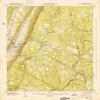
YellowMaps Valley Head AL topo map, 1:24000 Scale, 7.5 X 7.5 Minute, Historical, 1947, Updated 1947, 26.8 x 22 in - Paper
AED 575.27
AED 958.78
-
 Order within to get between
 -
 Tracked Shipping on All Orders
-
 14-Day Returns
- Secure Payments
-
 24/7 Customer Support
Description
- Printed on Regular Paper (32lb)
- USGS topographic map of Valley Head, AL, at 1:24000 scale. High-quality paper print. Perfect for wall maps.
- Cities, towns, villages: Mentone,Bankhead,Alpine,Lake Howard,Riverdale,Valley Head
- Rivers, creeks: Armstrong Branch,Shrader Branch,Blalock Branch,Sharp Branch,Gilbert Branch,Middle Fork Little River,Keiselburg Branch,Brush Creek,Hale Branch,Anna Branch,Laurel Creek,Wade Branch,Cannon Branch,Berry Creek,Seymour Branch,Coulter Branch,Stillhouse Branch
- Lakes: Moon Lake
Printed on Regular Paper
Shipping and Returns
- We offer tracked shipping on all orders. Tracking information will be shared as soon as the order is dispatched.
- Please check the delivery estimate before adding a product to the cart. This is displayed for every product on the website.
- Available shipping methods and charges will be displayed at the time of checkout, depending on your exact location.
- All customers are entitled to a return window of 14 days, starting from the date of delivery of the product(s).
- Customers are advised to read our return policy for details of the return process, eligibility, refunds as well as cancellations or exchanges.
- In case of any issues or concerns about Shipping or Returns, please contact us and we will be happy to help.
YellowMaps.
YellowMaps Valley Head AL topo map, 1:24000 Scale, 7.5 X ...
AED 575.27
AED 958.78