

Description
- Printed on Tyvek (synthetic)
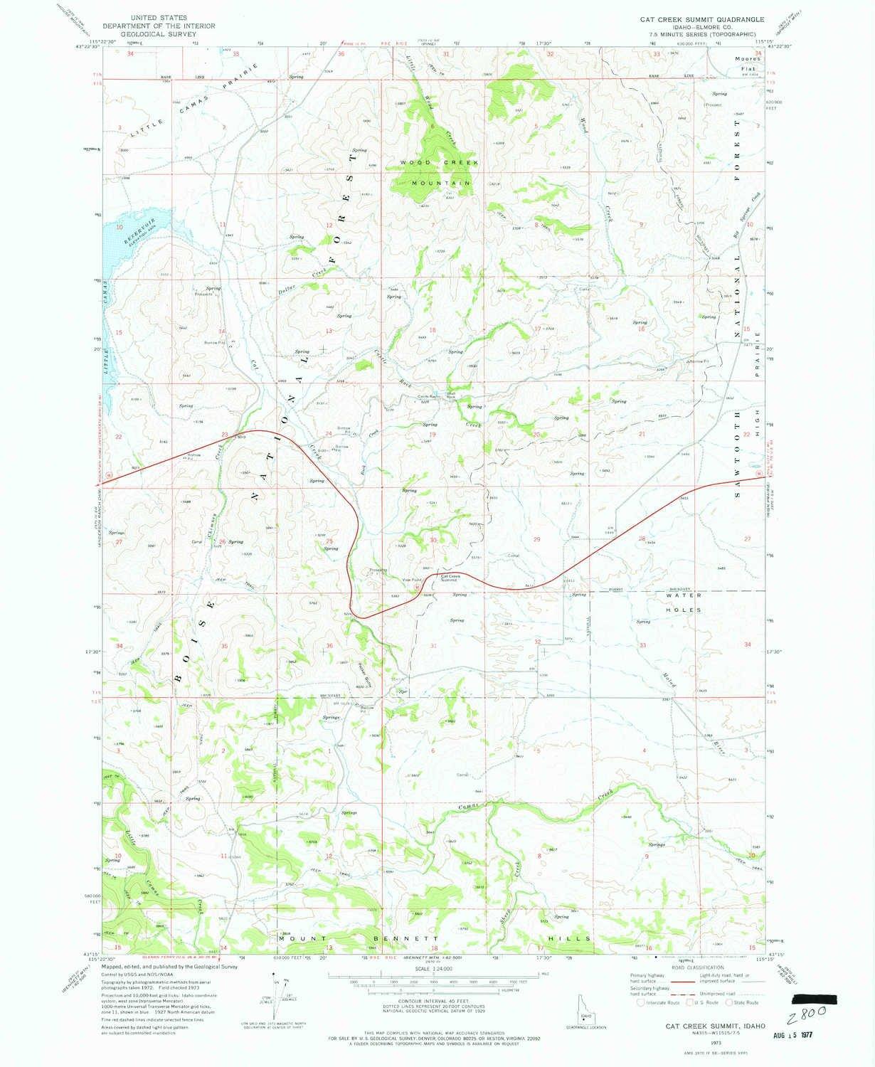
- USGS topographic map of Cat Creek Summit, ID, at 1:24000 scale. Lighter material. Waterproof. Tear-resistant. Foldable. Very durable. Perfect for backpacking and the outdoors.
- Cities, towns, villages: Castle Rocks
- Mountains: Packer Butte,Packer Butte,Cat Creek Summit,Wood Creek Mountain
- Valleys: Low elevation topographic features such as flatlands, river valleys, and canyons.
USGS topographic map of Cat Creek Summit, Idaho, dated 1973, updated 1977.
Includes geographic coordinates (latitude and longitude), lines of elevation, bodies of water, roads, and more. This topo quad is suitable for recreational, outdoor uses, office applications, or wall map framing.
Printed on-demand by YellowMaps on the print material of your choice.
Shipping rolled from Minneapolis, MN, United States.
Product Number: USGS-5431126
Map Size: 26.8 inches high x 22 inches wide
Map Scale: 1:24000
Map Type: POD USGS Topographic Map
Map Series: HTMC
Map Version: Historical
Cell ID: 69574
Scan ID: 235613
Imprint Year: 1977
Woodland Tint: Yes
Aerial Photo Year: 1972
Field Check Year: 1973
Datum: NAD27
Map Projection: Transverse Mercator
Map published by United States Geological Survey
Map Language: English
Scanner Resolution: 600 dpi
Map Cell Name: Cat Creek Summit
Grid size: 7.5 X 7.5 Minute
Date on map: 1973
Geographical region: Idaho, United States
Northern map edge Latitude: 43.375
Southern map edge Latitude: 43.25
Western map edge Longitude: -115.375
Eastern map edge Longitude: -115.25
Surrounding map sheets (copy & paste the Product No. in the search bar):
North: USGS-5434499,USGS-5434501
East: USGS-5432554,USGS-5432556
South: USGS-5432158
West: USGS-5430246,USGS-5430244